South Pinnacle Traverse
- Oct 22, 2024
- 3 min read
Updated: May 4
The South Pinnacle is 2544 metre nestled behind the Middle Pinnacle (2515 metre) nearby Monashee Lake located in the southern Monashee Mountains. The South Pinnacle Traverse is located in the Pinnacle Hiking Area within a few hours drive from Vernon, BC.

The Hike
To reach the trail-head, drive toward Cherryville, BC onward to the South Fork Forest Service Road (FSR). In recent years, be aware that the start of the FSR has been rerouted further south. The drive to the trail-head is straightforward; during the weekdays, there may be logging traffic.
Once at the trail-head, the hike to Monashee Lake is pleasant. I ascended through some old growth forest then through a tunnel of slide alder followed by hiking up a dry creek bed. Sometimes the density of plants and flowers can obscure the trail to the dry creek bed. However, it is the dry creek bed to your left. Not long after hiking up the dry creek bed, there is a short section of scree with a fixed rope for assistance. Ascending through sub-alpine, I arrived at Monashee Lake.

From Monashee Lake (picture above), I made my way to the Middle Pinnacle (notable peak to the right in the picture above). To do so, I traversed around the left side of the lake then ascended next to the creek that flows into Monashee Lake. Shortly afterwards, I reached an area with a small tarn. I traversed to the left of this tarn. I soon met a band of small trees at the base of the ridge that connects to the Middle Pinnacle. I followed this ridge up to the Middle Pinnacle and I got to the base of the Middle Pinnacle.

The Middle Pinnacle is a straight forward scramble. I traversed below the remnants of a glacier (right side of picture above) toward the bottom of the line of snow in the picture (left side of picture above).

Once below the line of snow, I scrambled toward the summit along the rock on the left side of the picture. There is plenty of loose rock but there is solid rock underneath. The picture below shows the approximate angle of the slope.

The Scramble
Once I got to the rock band, I scrambled straight to the summit of the Middle Pinnacle. From this opening, I traversed a loose scree section to reach the ridge connecting to the South Pinnacle. I arrived at the point in the photo below.

From here, I followed the obvious ridge to the base of the South Pinnacle.
Once at the South Pinnacle, I chose to traverse to the left for class 4 scrambling.

In the picture above, I went up a chimney on the left that offers class 4 scrambling. This route has plenty of scree and loose rock. I had to sweep the rock with my hands as I scrambled to create secure footholds for my feet. At the time of my ascent, there was a very large precariously positioned choke-stone in the chimney. It required a few delicate moves to get around it. Without the choke-stone, the chimney may be easier.

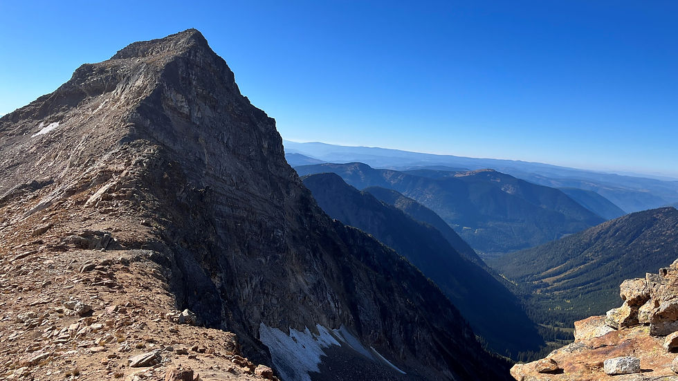
The summit of the South Pinnacle offers beautiful views of the surrounding peaks. On this day, I could see the south side of the North Pinnacle in the picture above (right side of the picture). I could see the south side of the Middle Pinnacle (left side of the picture). Once at the top, I reversed the route back to the trail-head.

Final Thoughts
The South Pinnacle Traverse offers an enjoyable day in the mountains with class 3 or 4 scrambling. Given the loose rock, it is likely best suited to experienced hikers/scramblers.
Comments